
By - Ainhoa Gonzalez del Campo, Christine Bonnin, Eoin O’Mahony from the School of Geography, UCD.
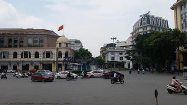 Photo 1: a view from Hanoi's Opera House.
 The SDGs span a continuum of interdependent social (e.g. no poverty, zero hunger, quality education, and well-being), economic (e.g. economic growth, innovation in industry) and environmental considerations (e.g. life on land and water, and climate). Aptly, Goal 4 which focuses on ‘quality education’, refers to the importance of inclusivity and equitability in access to quality education in order to improve people’s lives and sustainable development. While the targets and indicators for Goal 4 concentrate importantly on gender-equality in education and basic literacy (i.e. primary and post-primary completion), it also includes the provision of appropriate skills to promote sustainable development which are of particular relevance in higher education.
Geographic Information Systems (GIS) – digital systems that enable us to work with, analyse and visually represent geographic information – are important tools that can help societies make evidence-based decisions to address pressing global sustainable development challenges. While GIS have become an important support tool in the global development and humanitarian sector, at present, very few higher education programmes in development studies integrate it as a key component. This is a problem for the implementation of the SDGs locally. Yet, highly promising opportunities arise for the use and proliferation of free and open source geospatial software in development education and practice. Of particular importance is the easy accessibility of this technology to institutions in the Global South at little to no cost, which can contribute to reducing global spatial inequalities in access to educational resources through its adaptation into online education. However, in spite of the ongoing technological advancements in both the practice of online education and free software, research on the contribution of open source GIS and open data to the educational sphere, and ultimately to student preparedness and employability, is very limited.
In this blog post we would like to showcase how a project we are working on in Vietnam enables university students there to avail of free and open source software to aid in the implementation of the SDGs, particularly around the goal of quality education. All human interventions on human and natural landscapes have a spatial component and GIS software analyses these components in relation to each other. Moreover, they represent key analytical software for seeking solutions to critical current and future global sustainable development challenges like climate change, migration, poverty alleviation and food security.
As a country, Vietnam is relatively well developed, with significant improvements in human health and infrastructure in recent years. The Vietnam 2035 report has however identified numerous lingering challenges, linked to the spatial inequality of socio-economic development, environmental sustainability and climate change. On the basis that these development challenges can benefit from a geographical perspective, as socio-economic and environmental issues are intrinsically spatial, a proposal was put forward to incorporate GIS teaching and learning into development studies in Vietnam. As a result, in 2017, geographers at University College Dublin (UCD), Ireland were awarded funding by the official development and aid agency Irish Aid under their Vietnam Ireland Bilateral Education programme (VIBE) to develop an online open source GIS module for deployment by project partners at the Faculty of International Studies, Hanoi University (HANU) in their development studies programme.
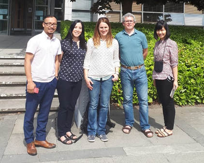
Photo 2: (L to R) Quoc Long Dang (HANU), Christine Bonnin (UCD), Ainhoa Gonzalez del Campo (UCD), Eoin O'Mahony (UCD) and Nguyen Hong Nga (HANU)
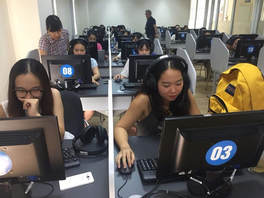 Photo 3: Students at HANU during the delivery of the first GIS for Development Studies module.
 Free and open source geospatial software (such as Quantum GIS or QGIS[1]) is now at a sufficiently mature stage to be used across a variety of contexts, and it is used by many municipal authorities, planning agencies and private sector companies. Their use is also growing in research and higher education contexts.
In the light of this, QGIS was purposefully adopted in the project to ensure continued accessibility to the technology by HANU’s staff and students both during and after module completion. Complemented by online instructional videos and task-based assignments, the UCD team developed a fully-fledged GIS module for use at HANU.
The module was provided as a set of practical handouts on GIS tools and functionality with accompanying video tutorials. Vietnam-specific data and examples were used to illustrate applications so that the module context would be directly relevant to the national and local development contexts. The students can access the lesson handouts locally on a USB drive and follow the accompanying demonstration videos on a dedicated private YouTube channel.
[1] https://qgis.org
 RSS Feed